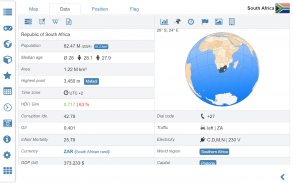
1/18
World atlas & world map MxGeo screenshot 0
World atlas & world map MxGeo screenshot 1
World atlas & world map MxGeo screenshot 2
World atlas & world map MxGeo screenshot 3
World atlas & world map MxGeo screenshot 4
World atlas & world map MxGeo screenshot 5
World atlas & world map MxGeo screenshot 6
World atlas & world map MxGeo screenshot 7
World atlas & world map MxGeo screenshot 8
World atlas & world map MxGeo screenshot 9
World atlas & world map MxGeo screenshot 10
World atlas & world map MxGeo screenshot 11
World atlas & world map MxGeo screenshot 12
World atlas & world map MxGeo screenshot 13
World atlas & world map MxGeo screenshot 14
World atlas & world map MxGeo screenshot 15
World atlas & world map MxGeo screenshot 16
World atlas & world map MxGeo screenshot 17
World atlas & world map MxGeo Icon

World atlas & world map MxGeo

HPB Labs
Trustable Ranking IconDipercayai
2K+Muat turun
46.5MBSaiz
Android Version Icon7.1+
Versi Android
9.1.2(09-01-2024)Versi terkini
5.0
(1 Ulasan)
Age ratingPEGI-3
ButiranUlasanVersiMaklumat
1/18

Perihal World atlas & world map MxGeo

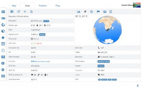
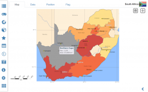
World atlas, world map and educational app for geography. Flags, position maps and basic data for more than 240 countries and territories of the world. Political maps with regional units and comprehensive economic and statistical country data for all African countries.


Designed for smartphones and tablets.


• Flags, position maps and basic data for more than 240 countries of the world

• Political maps and comprehensive data of all African countries

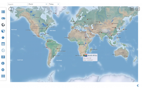
• Interactive political world and continent maps

• Shaded relief layer for world and continent maps

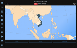
• Geography quiz challenge for playful learning

• Country comparison, favorites and distance calculator

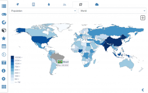
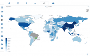
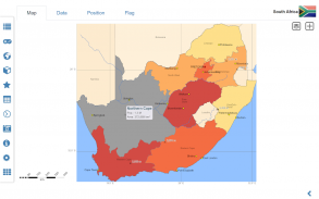
• Choropleth maps: area and population

• Configurable world clock with time zone display

• World-explorer: the smallest, largest, ... countries

• No online connection required


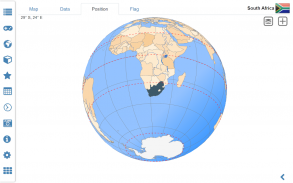
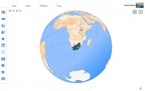
Explore the world by political world and continent maps offline maps. Learn where each country in the world is located. View its position highlighted on a digital globe. Create your favorite color theme or choose from different color schemes for map display.


Do you know the flag of Zambia? Yes? Perfect. Do you also know in which country Mount Kilimanjaro is located? “World atlas & world map MxGeo Free” Quiz helps you acquire a geographic literacy in a playful manner.

Choose from six geo guessing games:


• Test your knowledge about the capitals of Africa

• Do you know the ISO countries codes?

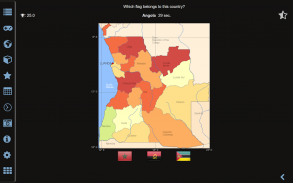
• Recognize the proper country flag based on the outline map

• Do you know the top-level domains of each country?

• Guess the highlighted country on the virtual globe

• Do you know the mountains of Africa?


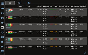
Geo learning app and educational game which is fun for everyone whether children, adults, seniors or teachers. Get ready for your next stay abroad while enjoying this great world almanac including time zones and statistical data, such as population growth, unemployment rate, average age, gross domestic product (GDP) by sector and other key figures. Or prepare for your next geography lesson with this genius digital world map. If not traveling our world atlas lets you explore the world just only virtually.


Free version includes comprehensive data and maps for all African countries. Get “World atlas & world map MxGeo Pro” with detailed data and maps including regional units and capitals for 240 countries and territories of the world: Europe, Asia, North America, Africa, Oceania and South America.


Version history:

Ver. 1.x:

• world map, country maps and flags

• capitals, country flag and virtual globe quiz

• world-explorer: explore the smallest, largest and most populated countries

• country comparison: quick comparison of countries and territories

• favorites: shortcut your favorite countries

• corrections and updates of country data and maps


Ver. 2.x:

• high resolution flags for all countries

• population growth chart for all countries

• no app permissions

• continent maps of Asia, Europe, South and North America and Oceania

• improved country comparison, with sorting function

• Full-screen mode for Android >4.4

• additional Geo Quiz: mountains of the world

• corrections and updates of country data and maps


Ver. 3.x:

• shaded relief layer for world and continent maps

• interactive rotating virtual globe

• performance optimization for map view

• optional high quality mode for virtual globe

• world clock: time zones map optimized

• corrections and updates of country data and maps


Ver. 4.x:

• countries maps update: now including neighbor countries and more details

• additional regional position maps incl. marine region info

• time series charts for gross domestic product (GDP) and unemployment rate added

• distances and areas can now be displayed in kilometers or miles

• info about voltage and plug types added

• adjustable font size for map labels

• choropleth maps by area and population

• world-explorer: new key figure average temperature

• corrections and updates of country data and maps

atlas dunia, peta dunia dan aplikasi pendidikan untuk geografi. Bendera, peta kedudukan dan data asas untuk lebih daripada 240 negara dan wilayah di dunia. peta politik dengan unit serantau dan data negara ekonomi dan statistik yang komprehensif untuk semua negara-negara Afrika.


Direka untuk telefon pintar dan tablet.


• Flags, peta kedudukan dan data asas untuk lebih daripada 240 negara di dunia

• peta politik dan data lengkap semua negara Afrika

• Interaktif dunia politik dan benua peta

• lapisan pelepasan digelapkan untuk dunia dan benua peta

• mencabar Geografi kuiz untuk pembelajaran suka bermain

• Negara perbandingan, kegemaran dan kalkulator jarak

• peta Choropleth: kawasan dan penduduk

• jam dunia dikonfigurasikan dengan paparan zon masa

• Dunia-explorer: yang paling kecil, terbesar, ... negara

• Tiada sambungan talian diperlukan


Meneroka dunia dengan dunia politik dan benua maps peta luar talian. Belajar di mana setiap negara di dunia terletak. Melihat kedudukannya menekankan pada dunia digital. Buat tema warna kegemaran anda atau pilih dari skim warna yang berbeza untuk peta paparan.


Adakah anda tahu bendera Zambia? Ya? Perfect. Adakah anda juga tahu Mount Kilimanjaro terletak di negara mana? "Dunia atlas & peta dunia MxGeo Percuma" Quiz membantu anda memperoleh celik geografi dengan cara yang suka bermain.

Memilih daripada enam geo meneka permainan:


• Uji pengetahuan anda tentang ibu Afrika

• Adakah anda tahu ISO negara kod?

• Mengakui bendera negara yang betul berdasarkan peta menggariskan

• Adakah anda tahu domain peringkat tertinggi bagi setiap negara?

• Guess negara yang diserlahkan di dunia maya

• Adakah anda tahu pergunungan Afrika?


Geo aplikasi dan permainan pendidikan yang menyeronokkan untuk semua orang sama ada kanak-kanak, orang dewasa, warga tua atau guru pembelajaran. Bersedia untuk penginapan anda yang seterusnya di luar negara sambil menikmati ini almanak dunia hebat termasuk zon masa dan data statistik, seperti pertumbuhan penduduk, kadar pengangguran, purata umur, keluaran dalam negara kasar (KDNK) mengikut sektor dan tokoh-tokoh utama lain. Atau bersedia untuk geografi pelajaran anda yang seterusnya dengan genius ini digital peta dunia. Jika tidak ke atlas dunia kami membolehkan anda meneroka dunia hanya hanya hampir.


Versi percuma termasuk data yang komprehensif dan peta untuk semua negara-negara Afrika. Dapatkan "Dunia atlas & peta dunia MxGeo Pro" dengan data terperinci dan peta termasuk unit dan ibu untuk 240 buah negara dan wilayah di dunia serantau: Eropah, Asia, Amerika Utara, Afrika, Oceania dan Amerika Selatan.


sejarah versi:

Ver. 1.x:

• peta dunia, peta negara dan bendera

• ibu, bendera negara dan dunia kuiz maya

• dunia-explorer: meneroka kecil, negara-negara yang terbesar dan paling padat

• perbandingan country: perbandingan cepat nama negara dan wilayah

• kegemaran: pintasan negara kegemaran anda

• pembetulan dan kemaskini data dan peta negara


Ver. 2.x:

• bendera resolusi tinggi untuk semua negara

• carta pertumbuhan penduduk untuk semua negara

• tiada kebenaran apl

• peta benua Asia, Eropah, Selatan dan Amerika Utara dan Oceania

• bertambah perbandingan negara, dengan fungsi sorting

• Mod skrin penuh untuk Android> 4.4

• Geo Quiz tambahan: gunung di dunia

• pembetulan dan kemaskini data dan peta negara


Ver. 3.x:

• lapisan pelepasan teduh untuk dunia dan benua peta

• interaktif berputar dunia maya

• pengoptimuman prestasi untuk paparan peta

• pilihan mod kualiti tinggi untuk dunia maya

• dunia jam: zon masa MAP dioptimumkan

• pembetulan dan kemaskini data dan peta negara


Ver. 4.x:

• negara maps update: sekarang termasuk negara-negara jiran dan maklumat lanjut

• Kedudukan serantau tambahan maps incl. info kawasan marin

• carta siri masa untuk keluaran dalam negara kasar (KDNK) dan kadar pengangguran ditambah

• jarak dan kawasan yang kini boleh dipaparkan dalam kilometer atau batu

• Maklumat tentang voltan dan plug jenis ditambah

• Saiz fon boleh laras untuk label peta

• peta choropleth oleh kawasan dan penduduk

• dunia-explorer: kunci suhu angka purata baru

• pembetulan dan kemaskini data dan peta negara


World atlas & world map MxGeo - Versi 9.1.2

(09-01-2024)
Versi lain
Apa yang baruVer. 5.0.4• New: optional dark themeVer. 5.0.3• Sort order in country lists corrected• Bug fix: favorites, world clock & country comparison• Country data update• Added Azores, Madeira and Canary IslandsVer. 4.x• Added shortcut links for dependent territories• Added Aland Islands, Channel Islands and Isle of Man• New: Distance calculator• Lists: retain the last scroll position• World-clock: now sortable• Advanced search by capital city, iso & dial code

Belum ada ulasan atau rating lagi! Untuk berikan ulasan yang pertama, sila

-
1 Reviews
5
4
3
2
1
Info Trust Icon
Aplikasi Bagus DijaminAplikasi ini lulus ujian keselamatan untuk virus, perisian hasad dan serangan hasad lain serta tidak mengandungi sebarang ancaman.

World atlas & world map MxGeo - Maklumat APK

Versi APK: 9.1.2Pakej: de.mediaz.mxapp.hpbgeodefree
Keserasian Android: 7.1+ (Nougat)
Pemaju:HPB LabsDasar Privasi:http://apps.mediaz.de/view/115-DatenschutzKebenaran:2
Nama: World atlas & world map MxGeoSaiz: 46.5 MBMuat turun: 1KVersi : 9.1.2Tarikh Diterbitkan: 2024-01-09 19:37:17Skrin Min: NORMALCPU yang disokong:
ID Pakej: de.mediaz.mxapp.hpbgeodefreeTandatangan SHA1: EA:52:47:52:19:7C:42:A3:18:10:6F:5E:D0:D3:92:F1:C8:35:4A:A1Pemaju (CN): HPBOrganisasi (O): HPB LabsLokasi (L): StuttgartNegara (C): DENegeri/Bandar (ST): BW

Versi Terkini World atlas & world map MxGeo

9.1.2Trust Icon Versions
9/1/2024
1K muat turun46.5 MB Saiz

Versi lain

8.9.8Trust Icon Versions
24/8/2023
1K muat turun46.5 MB Saiz
8.9.5Trust Icon Versions
9/6/2023
1K muat turun46.5 MB Saiz
8.7.2Trust Icon Versions
25/11/2022
1K muat turun46 MB Saiz
8.6.4Trust Icon Versions
28/7/2022
1K muat turun45 MB Saiz
8.6.0Trust Icon Versions
22/6/2022
1K muat turun45 MB Saiz
8.3.1Trust Icon Versions
13/11/2021
1K muat turun40.5 MB Saiz
8.2.9Trust Icon Versions
3/10/2021
1K muat turun40.5 MB Saiz
8.2.8Trust Icon Versions
6/8/2021
1K muat turun40 MB Saiz
6.8.10Trust Icon Versions
29/10/2020
1K muat turun40.5 MB Saiz

Aplikasi dalam kategori sama

Anda juga mungkin suka...